Mountain Bike Trails in Chattanooga
Chattanooga Mountain Bike Trail Guide
We get asked a lot where to ride when people are in town, so here's the rundown of our go-to spots, what kind of riding to expect at each, and links so you can pull up the maps yourself.
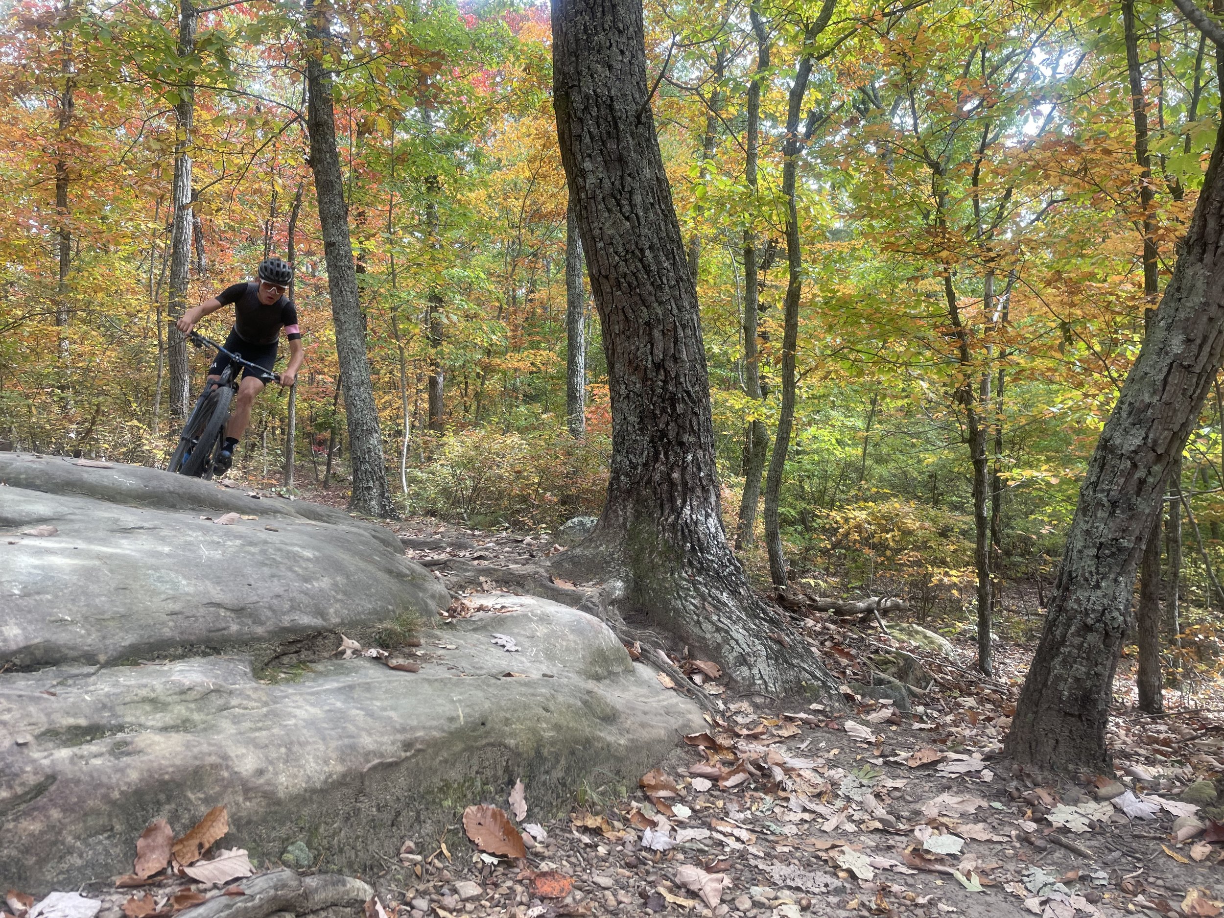
Raccoon Mountain
This is the trail system that put Chattanooga on the map for mountain biking. About 15 minutes west of downtown, with close to 30 miles of singletrack wrapped around the TVA pumped storage facility. It's classic Southern Appalachian riding — rocky, technical, switchback climbs, and real views of the river gorge and Lookout Mountain along the way. Most of it runs intermediate to advanced. There are a few green trails for newer riders, but this isn't really the beginner destination — it's the bucket-list one.
Enterprise South Nature Park
About 15 minutes northeast of downtown, built on an old Army ammunition plant. This is where we send people who want flowy, well-marked, beginner-to-intermediate riding without a lot of consequence if they make a mistake. TNT is the trail most people start with — 4-plus miles of green singletrack with an easy climb. Black Forest is another solid beginner loop. If you want more of a challenge, Atlas brings in rock features and steeper, more technical terrain. Trails are directional and change direction depending on the day, so check the map before you go.
Walden's Ridge Park
Out on Signal Mountain, about 10 minutes from downtown. This is Chattanooga's purpose-built downhill park, and it's the spot if you're looking for jumps, drops, berms, and actual flow trails instead of natural singletrack. Bread and Butter is the trail most people talk about — fast, flowy, all tabletop jumps, good for progression. There's also more technical, rock-heavy terrain if you want it. Heads up: no dogs allowed on the downhill-specific trails, and don't ride it wet — the trail builders mean it.
Stringer's Ridge
If you're staying downtown and only have an hour, this is the ride. It's a 92-acre park in North Chattanooga, about 10 minutes from downtown, with 7 miles of well-groomed multi-use trails and a solid overlook of the city. Rolling hills, a few short steep sections, nothing too technical. It's also the closest thing Chattanooga has to a true in-town singletrack option, so it's a good one to squeeze in before dinner or after a work call.
Five Points / Cloudland Canyon Connector
About 30 minutes from downtown near Trenton, Georgia, in an old coal town area. This one gives Raccoon Mountain a real run for "best trail system in the region" — it's got a bit of everything, from beginner-friendly loops to genuinely tough technical sections. The Cloudland Connector is the main multi-use trail through here, wide and rideable for all levels (horses are even allowed on it), and it ties into the broader River to Clouds route if you want to turn it into a bigger day. Worth the extra drive time.
Lookout Mountain (Guild, CCT, and John Smart Trail)
Lookout Mountain is more known for hiking, but the Guild and John Smart Trails connecting to the CCT (Cloudland Connector Trail) is the one worth knowing about if you're on a bike — it's part of a larger multi-use network connecting the base of the mountain up to the historic battlefield trails, and it ties into the 34-mile River to Clouds route if you're feeling ambitious. Expect a real climb, technical sections, and some of the best views in the area once you're up top. This is a "know before you go" system — check current trail status and which sections allow bikes before you commit.
White Oak Mountain
Out in Collegedale, about 20 minutes east of downtown — locally called the Biology Trails since they sit on Southern Adventist University's campus. This is a 25-mile stacked loop system, meaning it's built so you can start easy near the trailhead and work your way into harder, rockier, root-covered terrain as you climb higher. Two things make this one stand out: it drains fast after rain, so it's rideable sooner than most Chattanooga systems, and it's open until 10 PM daily — the go-to spot for night riding and after-work laps in the winter.
Hawkins Ridge (St. Elmo)
Short but sweet, and one of the better-kept-secret neighborhood trails in town. It sits between St. Elmo and Alton Park, just north of the Georgia line. This isn't a big-mileage destination — it's the trail you hit when you've got 30-45 minutes and want quiet singletrack without driving out of the city.
Aetna Mountain
Tucked into the Black Creek neighborhood in Lookout Valley, this is one of Chattanooga's newest systems, opened in 2023 by the Tennessee River Gorge Trust. Right now it's around 4 miles with a green beginner loop and a blue intermediate loop, and there's more coming as phases two and three get built out toward 8+ miles total. Good flow, some technical features, nothing too big — a great after-work lap, and a nice one to keep an eye on as the new mileage comes online.
A Few Notes
All of these are covered on Strava too — search the park or trail name and you'll find the local segments and see how you stack up. Trailforks also shows the most popular Strava segments and ride logs for each system if you want to scope it out before you go.
If you're new to the area, new to mountain biking, or just want a route dialed in for your fitness and what you're looking to get out of the ride, reach out. Happy to help you navigate the trail systems or put together a route that actually fits what you want that day.
If you have any questions or need someone to help with riding skills, efficiencies, safety, or want a guide to take you on these trails, reach out below.
Check out SORBA Chattanooga for more information and trail conditions